The Keurbooms River, Plettenberg Bay’s quieter neighbour to the east, is the line most Garden Route visitors cross without noticing — usually because they are on the N2 doing 100 km/h, watching for the turn-off to their guest house. Slow down. Eight kilometres of river estuary sit on your left, a 740-hectare nature reserve sits behind it, Keurboomstrand beach sits on the right, and the whole thing is doing more for Plettenberg Bay’s wildlife than anything closer to town. This is the guide I would hand a friend who had a free day in Plett and wanted to actually use it.
What is the Keurbooms River?
Short answer, for anyone who came here for the facts: the Keurbooms River is about 85 km long (per Wikipedia). It rises south of Uniondale in the Langkloof, on the inland side of the Outeniqua Mountains, drains a 1,080 km² catchment, and reaches the Indian Ocean through the Keurbooms Estuary about 8 km east of Plettenberg Bay. Its main tributary is the Bitou. On the seaward side of the estuary mouth sits Keurboomstrand, a Blue Flag beach 10 km from Plett centre.
Now the longer version. Some SA tourism pages cite 60 km, probably referring to a navigable or named-stretch subset — but Wikipedia lists the full river at 85 km, and the Bitou (also spelled Bietou) gives its name to the surrounding Bitou Local Municipality. The headline either way: this is a substantial Garden Route river, not a coastal stream.
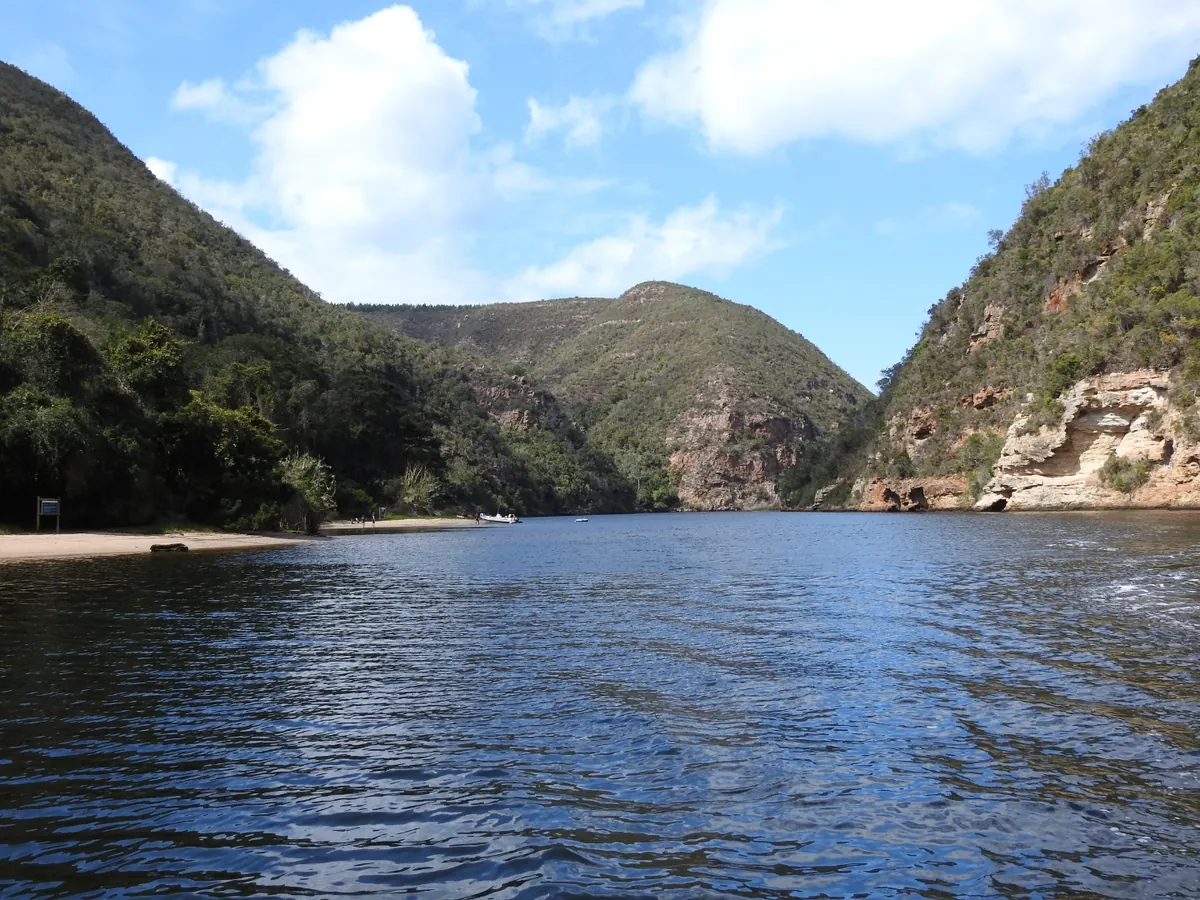
What makes the Keurbooms unusual on this coast is its terminal stretch. The last ~10 km of the river runs through a forested gorge that opens out into a wide tidal estuary before squeezing through a narrow sandbar to the sea. CapeNature describes the river as bringing “an abundance of water from further up in the Tsitsikamma Mountains” into the ocean via the estuary — which captures the geography well, though Wikipedia’s source attribution points further inland to the Langkloof side of the Outeniqua range. The reserve catches the gorge section; Keurboomstrand catches the mouth.
The estuary, the lagoon, the beach — how they fit together
Locals use three names for the same general body of water, and travel writing routinely confuses them.
- Keurbooms River — the river itself, including the long upstream section through the gorge inside the reserve.
- Keurbooms Estuary (sometimes “Keurbooms Lagoon”) — the wide tidal pond that sits behind the sandbar. South African Tourism calls it Keurbooms Lagoon and notes it’s a five-minute drive from Plett centre. CapeNature and the bird-watching community call it the Keurbooms Estuary. Same water.
- Keurboomstrand — the resort town and its beach, on the seaward side of the mouth.
The reason this matters: each piece has a different access rule, a different fee, and a different reason to visit. The reserve is for trees, paddling and the canoe trail. The estuary is for the ferry, fishing, and windsurfing on the wider flat water. The beach is for swimming and whale-watching from the dunes. You can do all three in a day; you can also pick one and have it to yourself for an afternoon.
How to get there — and what’s where
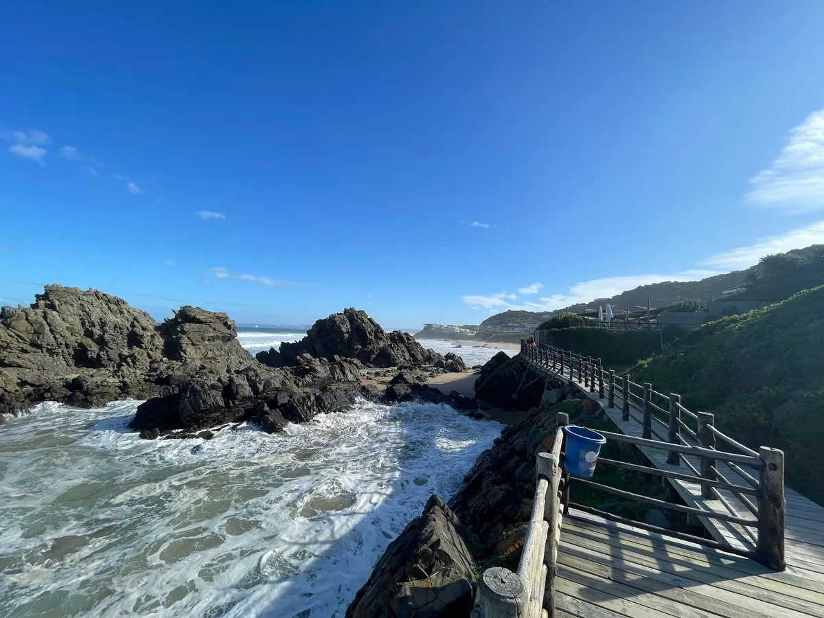
From central Plett, take Marine Way onto the N2 heading east. You’ll cross the Keurbooms River on the N2 bridge after about 5 km — slow down here, because the bridge is a one-shot photo of the estuary. The reserve access road turns off the N2 just east of the bridge, then loops inland along the river. The Keurboomstrand beach access road also turns off the N2 just past the bridge, signposted for “Keurboomstrand”. Both are five-minute follow-ons from the bridge; the beach is on your right, the reserve on your left.
Driving times worth knowing (Plett Tourism gives the Keurboomstrand figure; the rest are approximate Google Maps numbers):
- Plett Central → Keurboomstrand beach: 10 km / 15 minutes (Plett Tourism)
- Plett Central → Keurbooms Estuary / ferry dock: roughly 8 km / 10 minutes
- Plett Central → Keurbooms River Nature Reserve gate: roughly 12 km / 15 minutes (a few extra kilometres inland along the river)
- George Airport (GRJ) → Keurbooms: about 95 km / 1 hr 15 min east on the N2
- Knysna → Keurbooms: about 35 km / 30 minutes east on the N2
Cell signal is patchy inside the reserve gorge and at the back of Keurboomstrand. Bank on data not working at the canoe trail; bank on it working fine at Enrico’s on the beach.
Keurbooms River Nature Reserve — CapeNature
The Keurbooms River Nature Reserve is the wild side of the system. It’s a 740-hectare CapeNature reserve along the river gorge, proclaimed in 1980 specifically to conserve the Afromontane floodplain forest — a vegetation type CapeNature notes is not formally conserved anywhere else in South Africa. That’s the headline reason to visit. The other reasons stack quickly once you arrive.
Practical detail you’ll want before going:
- Day access: R75 per adult, R55 per child aged 4–17 (CapeNature). Pay at the gate.
- Gate hours: 07:30–16:00 daily per Google’s current listing. CapeNature’s own page quotes office hours of 08:00–17:00 — those are likely admin office hours; the gate runs to the earlier closing time. Plan to be out by 16:00.
- What’s permitted: swimming in the river (“Visitors are welcome to swim in the Keurbooms River” per CapeNature), angling (with a valid CapeNature permit), picnics at the riverbank sites, and a 5 km canoe trail.
- Overnight option: the Whiskey Creek Cabin — a self-catering CapeNature cabin reachable only by paddling the 5 km canoe trail. Book through CapeNature; sleeps small parties. Phones do not work; this is the point.
The trees here are the show. Indigenous Garden Route forest species — yellowwoods and stinkwoods among them — grow on a floodplain rather than a slope, which gives the reserve its slightly different feel from the more famous Knysna forests further west.
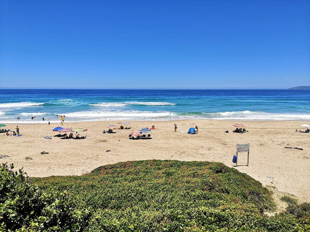
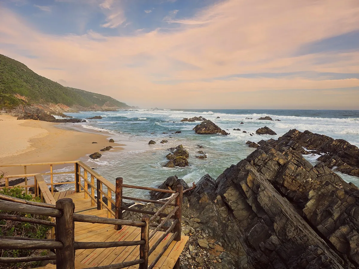
Keurboomstrand — the beach side
If the reserve is the wild side, Keurboomstrand is the beach. It’s a long, straight, mostly-sandy stretch on the seaward side of the estuary mouth, 10 km from Plett centre, with Blue Flag status confirmed by Plett Tourism. The adjacent Dunes Beach also carries Blue Flag status — making this two of Plett’s six Blue Flag beaches sitting almost side-by-side.
Plett Tourism describes Keurboomstrand as “a little wilder, but equally beautiful” compared with Central Beach in town — which is fair. The shore-break is bigger, the wind is stronger, the people are fewer, and lifeguards are on duty in season only (roughly the December summer holiday window and Easter). Outside season, the beach is yours; in season, it’s a busy family beach with the usual SA holiday-coast mix of body-boarders, swimmers and dog-walkers.
The 2011 census put Keurboomstrand’s population at 475, across 9.75 km² — so there’s almost nothing here in the way of infrastructure beyond a handful of beach-access roads, the Enrico restaurant, a few self-catering villas and a slipway. That low-density character is the point.
A small note for history-minded visitors: the Matjes River Rock Shelter, with San artefacts Wikipedia dates to the Neolithic period around 11,000 years ago, sits a short walk along the coast from Keurboomstrand. It’s not a developed attraction, but it’s there.
A walk-through of Keurboomstrand from the Garden Route, framed as a visitor’s-eye view of the beach and river mouth. Video — Travelistic_SA on YouTube
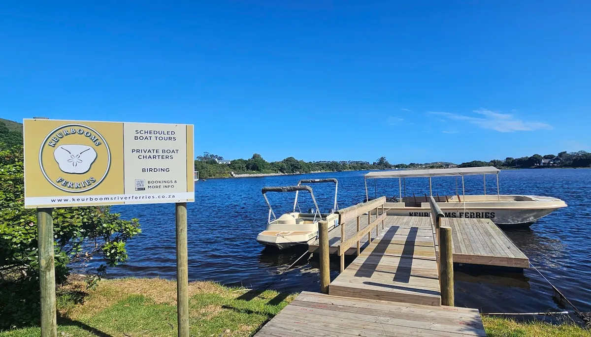
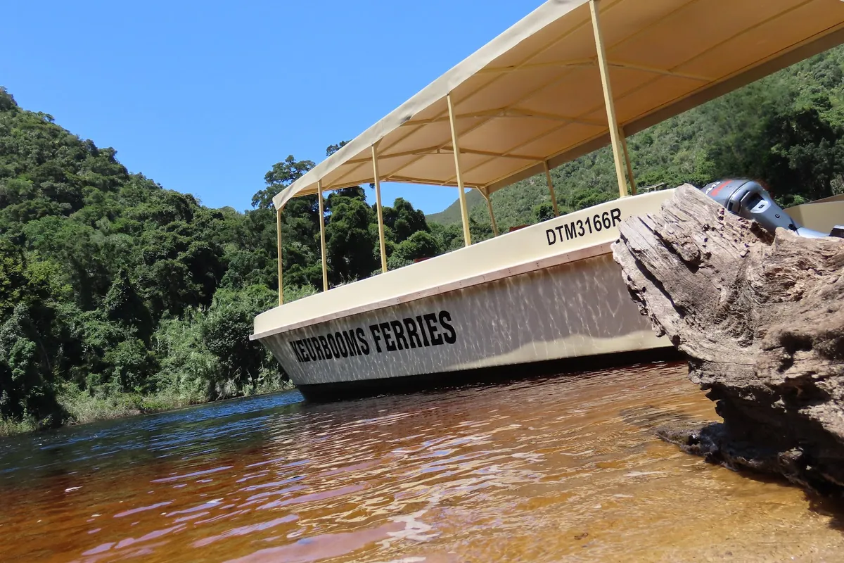
The Keurbooms River Ferries cruise
The single best way to see the reserve without paddling it is the Keurbooms River Ferries cruise. It leaves from a small dock on the estuary just off the N2, runs 5 km upstream into the gorge, and pauses on a “naturally formed riverbank” — the operator’s words — where you can get off and walk in the forest before the boat returns. The cruise covers the part of the river that no road touches.
Practical notes from the operator site itself:
- The boat does not sell food or drink — bring a picnic. Toilets at the midway riverbank stop.
- Phone +27 (0)69 733 0410 or email [email protected]. Ingrid Botes runs it.
- Operating hours per Google: 08:00–17:00 Monday to Friday, 09:00–13:00 Saturday, closed Sunday. Cruises are scheduled; book ahead in peak summer.
- Plett Tourism describes the route as “a unique forest and gorge experience, accessible only by water” — which is the part that justifies the cost. The road simply doesn’t go there.
Canoeing and the Whiskey Creek Cabin
For people who want to do it under their own steam, CapeNature runs a 5 km canoe trail along the river from the reserve gate to the Whiskey Creek Cabin — a small, off-grid self-catering cabin reachable only by paddle. You bring everything (or hire canoes near the gate), paddle in, sleep, paddle back. Not for first-time paddlers — the tide direction matters and the river is wider than it looks — but the most “Garden Route forest” night you can have within twenty minutes of town.
Whale watching from Keurboomstrand
Plettenberg Bay was named South Africa’s third Whale Heritage Site by the World Cetacean Alliance in May 2023 — after The Bluff in Durban and Algoa Bay. Keurboomstrand sits inside the heritage area and shows up on Plett Tourism’s list of cliff-based viewing spots. From the headland at the eastern end of the beach, you can scan the whole bay through binoculars in season.
The three species worth knowing about:
- Southern right whales — visit June to October to breed and calve, per Wildlife Heritage Areas. These are the slow, easy-to-spot calving cows that loiter close to shore.
- Humpback whales — pass between May and December on migration.
- Bryde’s whales — permanent residents of the bay, per Plett Tourism, often seen in social groups year-round.
Plett Tourism gives May through October as the canonical “migratory whale route” window. The most reliable boat-based whale watching leaves from Central Beach in Plett rather than from Keurbooms — for the full breakdown including operators, species, and what to expect on a trip, our companion piece on whale watching in Plettenberg Bay covers that side. From Keurboomstrand itself you’re doing it from the dunes — bring a long lens and patience.
Safety — tides, currents, the river mouth
Two hazards, same as any tidal estuary on this coast.
The mouth. A lot of water moves through the sandbar twice a day. Outgoing tide is fast and unidirectional; incoming tide stacks against the ocean swell. CapeNature’s “Visitors are welcome to swim” wording refers to the upstream reserve, not the mouth — don’t swim across the channel, and don’t put kids on inflatables in it.
The open beach. Shore-break and rip currents like every Garden Route ocean beach. Lifeguards in season; swim between the flags. Out of season, assess conditions yourself.
Best time to visit
Year-round system — the right answer depends on what you came for.
Whale season (May to October): the canonical Plett window per Plett Tourism. Southern rights from June; Humpbacks from May; Bryde’s all year. Cooler air, smaller crowds, sharp winter light on the estuary. My favourite for the reserve.
Summer (December to February): lifeguards on the beach, water around 18 °C, surf up, Enrico’s terrace full, canoe hire busy. Book the ferry ahead.
Shoulder (March/April, October/November): the sweet spot. Warm enough to swim, empty enough to park anywhere, lifeguards still in for Easter, and the gorge at its lushest. Skip the river the week after big Langkloof rain — it runs muddy.
Where to eat at Keurbooms
There’s effectively one significant restaurant on the beach and a handful of seasonal cafés around it. Enrico’s is the one.
For anything beyond Enrico, you drive the ten minutes back into Plett. The town’s central restaurant cluster — Lookout Deck, The Table, Le Fournil — has the full range, and our things to do in Plettenberg Bay piece covers the food side in detail.
Where to stay near Keurbooms
The honest picture: the actual Keurbooms River Estuary itself has very little stand-alone self-catering stock. The closest cluster is Goose Valley Golf Estate, a gated golf estate on the western side of the N2 bridge with a direct line of sight across to the Keurbooms Estuary — about 3 km from the ferry dock and 5–7 minutes’ drive from Keurboomstrand beach. The three Goose Valley properties below are the best-rated stays you can book within striking distance of the river.
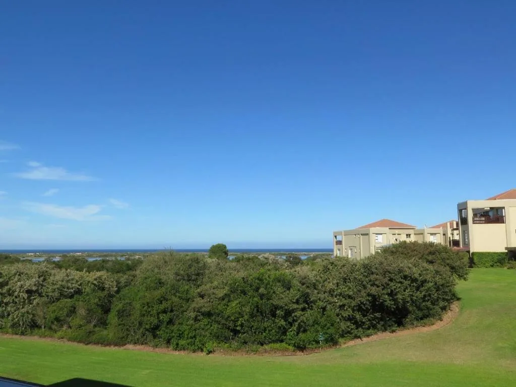
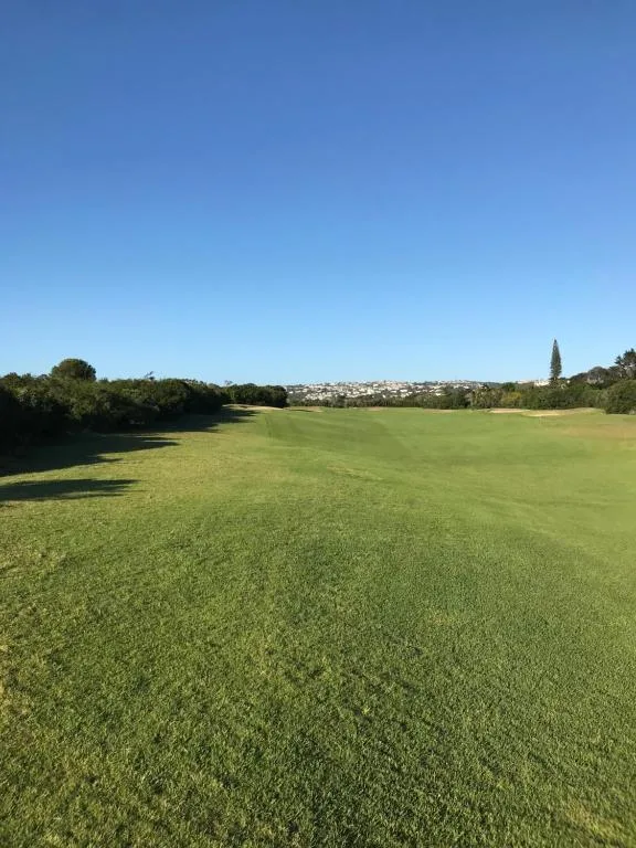
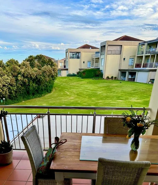
Goose Valley is on the N2 just west of the Keurbooms bridge — you cross the river to reach the beach, the reserve, or Enrico’s. For something literally on the seaward side of the estuary, look at Keurboomstrand proper: stock is thin (the village has under 500 permanent residents) but a handful of beach-facing self-catering units exist, plus The Dunes Hotel and the Forever Resorts complex if you’d rather a serviced stay.
Keurbooms on the map
Keurbooms-area stays + what's around them
The Goose Valley Golf Estate cluster sits just west of the N2 bridge — closest bookable self-catering stock to the Keurbooms estuary, river ferry dock, reserve gate, Keurboomstrand beach and Enrico's.
How Keurbooms fits a Plett trip
Most visitors do Keurbooms in one of three shapes.
Half-day from town (most common): drive out after breakfast, do the ferry cruise into the reserve (book the 09:30 or 10:30 departure), eat the picnic on the midway stop, head to Enrico’s for lunch on the beach, drive back to Plett for the afternoon. Two main attractions, half a day, no rushing.
Full day with paddle: ferry in the morning, swim in the upstream reserve pool around noon, beach in the afternoon. Skip Enrico in season unless you’ve booked.
Two-night overnight in the cabin: if you can paddle, book the Whiskey Creek Cabin through CapeNature for one or two nights. The full experience — gear in, gear out, no signal, just forest and river. Build a Plett trip around it rather than tucking it in.
If you’re plotting a wider Garden Route itinerary, Keurbooms is the natural pivot point between Plett and the Tsitsikamma — you can stop here on the way east toward Storms River, or as a half-day out from a Plett base. Either way, it earns the half-day.
Sources
- CapeNature — Keurbooms River Nature Reserve — reserve size (740 ha), fees, hours, swim permission, canoe trail, Whiskey Creek Cabin
- Wikipedia — Keurbooms River — river length (~85 km), source in the Langkloof, Bitou tributary, catchment 1,080 km²
- Wikipedia — Keurboomstrand — name etymology, population (475), Matjes River Rock Shelter
- Plett Tourism — Plett beaches — Blue Flag status, 10 km / 15 min to Plett Central, lifeguards in season
- Plett Tourism — When is whale season — May–October migratory window, Bryde’s residents, Keurboomstrand cliff-viewing
- Keurbooms River Ferries — 5 km upstream cruise, riverbank stop, no food sold, +27 (0)69 733 0410
- Wildlife Heritage Areas — Plettenberg Bay — Humpback May–December, Southern right June–October
- South African Tourism — Keurbooms Lagoon — 200+ bird species, windsurfing, indigenous forest
- Knysna Basin Project — Keurbooms Estuary — Eelgrass (Zostera capensis) beds, productive estuary food web
- CapeNature — A journey to Keurbooms Nature Reserve (Scott Ramsay) — 1980 reserve proclamation, Afromontane floodplain forest conservation rationale
- Surf-forecast.com — Keurbooms — sea temperature data
Frequently asked questions
Where does the Keurbooms River start?
The Keurbooms River rises south of Uniondale in the Langkloof, on the inland side of the Outeniqua Mountains in South Africa's Western Cape. From its source at roughly 1,000 metres elevation it runs in a south-easterly direction for about 85 km, picks up the Bitou (Bietou) as its main tributary, then enters the Indian Ocean through the Keurbooms Estuary just outside Plettenberg Bay.
How far is Keurbooms from Plettenberg Bay?
Closer than people expect. The Keurbooms Estuary and the Keurbooms River Nature Reserve are about 8 km east of central Plett — a 10-minute drive on the N2 across the river bridge. Keurboomstrand beach, on the seaward side of the estuary mouth, is 10 km / 15 minutes from Plett Central per Plett Tourism. Most visitors do it as a half-day from town rather than a separate base.
Can you swim in Keurbooms?
Yes — upstream of the mouth. CapeNature states that visitors are welcome to swim in the Keurbooms River inside the nature reserve, and the calmer pools above the tidal zone are genuinely pleasant on a warm day. The estuary mouth itself is a different story — strong tidal currents pour through it twice a day and you do not want to be in the water there. Swim above the bridge, or at the beach in lifeguarded season.
Can you swim at Keurboomstrand?
Yes. Keurboomstrand holds Blue Flag status per Plett Tourism, with lifeguards on duty in season (roughly December to mid-January and Easter). It is more open than Plett's central beaches — a long, straight sandy stretch with shore-break surf — so check the conditions before getting in and stay between the flags. The adjacent Dunes Beach also carries Blue Flag status.
What is the water temperature at Keurbooms beach?
Mid-teens to high-teens Celsius for most of the year. Surf-forecast.com reports recent Keurbooms sea temperatures around 18 °C; summer (December to February) sees the warmer end of that band. It is the same Indian Ocean as Plett's central beaches — a few degrees cooler than KwaZulu-Natal, a few degrees warmer than Cape Town's Atlantic side.
What makes Keurbooms unique?
Two things. First, CapeNature notes the reserve was proclaimed in 1980 specifically to conserve the Afromontane floodplain forest, which is not formally conserved anywhere else in the country. Second, the Knysna Basin Project reports that a large portion of the Keurbooms Estuary system is made up of Eelgrass (Zostera capensis) beds — a seagrass that supports an unusually productive estuarine food web.
Are there whales in Plettenberg Bay?
Yes — Plettenberg Bay was named South Africa's third Whale Heritage Site by the World Cetacean Alliance in May 2023. Plett Tourism describes the bay as part of the migratory whale route from May to October; Humpback whales pass between May and December, Southern right whales appear from June to October to breed and calve, and Bryde's whales are permanent residents seen year-round. Keurboomstrand is on Plett Tourism's list of cliff-based viewing sites.
What are the Keurbooms known for?
Three things, depending on who you ask. CapeNature visitors come for the river-and-forest reserve and the canoe trail to the Whiskey Creek Cabin. Beach-goers come for Keurboomstrand — a Blue Flag beach 10 km from Plett centre, calmer in temperament and louder in surf than Plett's central beaches. And the estuary itself is one of South Africa's most productive lagoon systems, fed by the river from inland and flushed daily by the Indian Ocean.


