
Where does the Garden Route start and end? It officially starts at Mossel Bay in the Western Cape and ends at Storms River in the Eastern Cape — a roughly 230 km stretch of coastline along South Africa’s N2 highway. We host visitors along the Garden Route year-round, and it’s the single question we field most often from first-timers. The short answer is simple. The useful answer — the one that actually helps you plan — takes a little more unpacking.
In order, the towns you’ll tick off on the N2 are Mossel Bay → George → Wilderness → Sedgefield → Knysna → Plettenberg Bay → Nature’s Valley → Storms River. You can drive the whole route in a long afternoon if you really have to. We’ve yet to meet anyone who was glad they did.
The official Garden Route boundaries
The Garden Route isn’t just a marketing phrase. It’s a formally defined region set by the Garden Route District Municipality (headquartered in George) and echoed by South African Tourism and SANParks — both use Mossel Bay to Storms River as the standard boundary, with Garden Route National Park anchoring the middle and eastern sections.
The western start — Mossel Bay
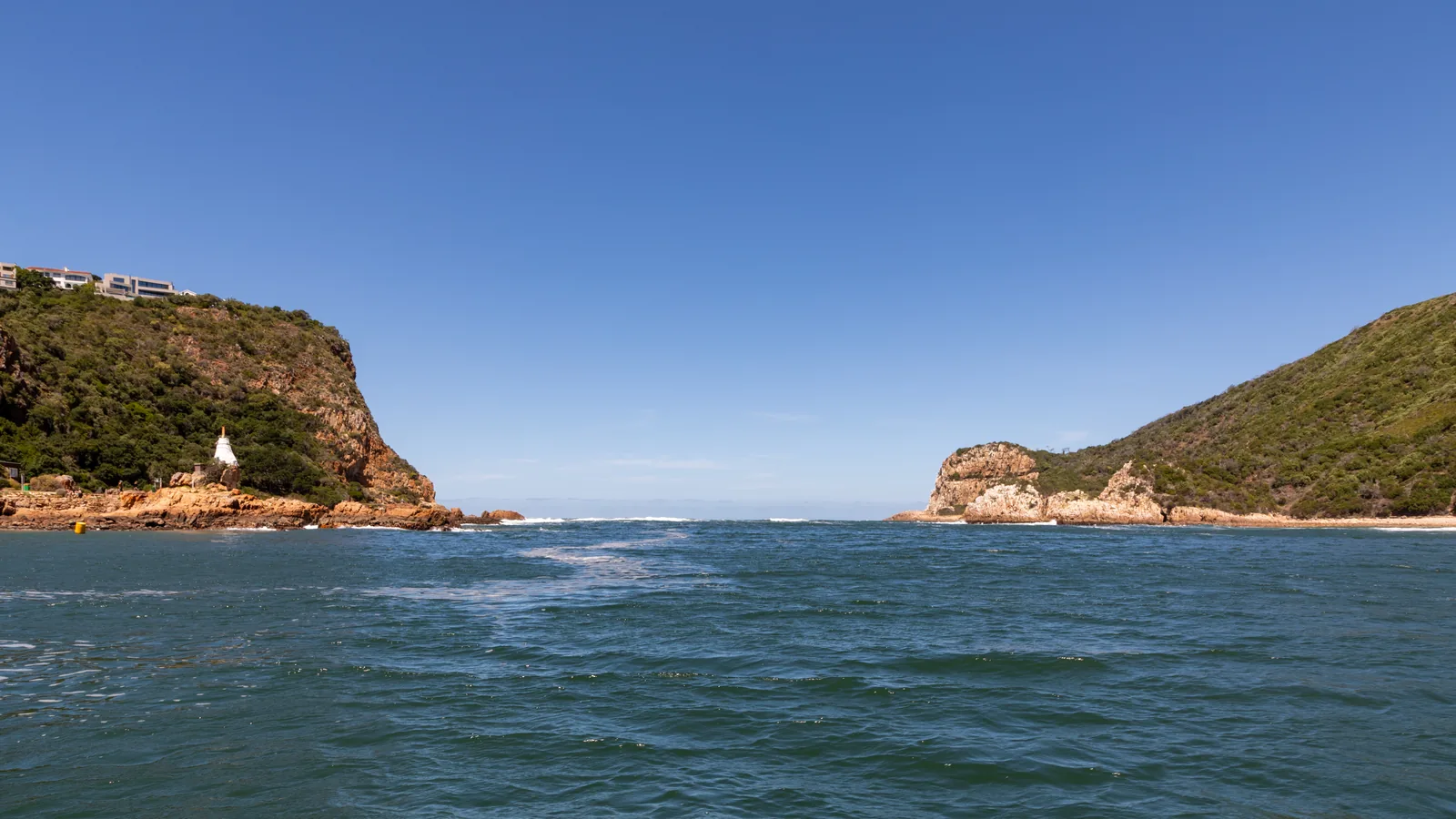
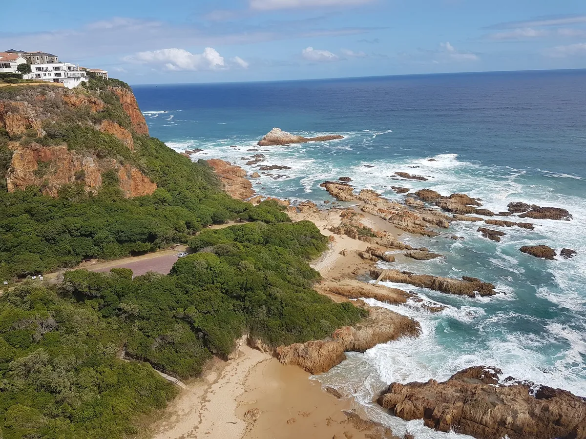
Mossel Bay is where the coastline turns properly Garden-Route-green. Drive in from Cape Town along the N2 and you’ll cross the Gouritz River Bridge; within twenty minutes the landscape shifts from dry Overberg scrub to rolling farmland and indigenous bush. Mossel Bay is also home to Pinnacle Point, where archaeological digs have found evidence of modern human occupation dating back around 170,000 years — the town has a credible claim to being one of the oldest continuously inhabited spots on the planet. Mossel Bay accommodation tends to be better value than anywhere else on the route, which makes it a natural first or last night.
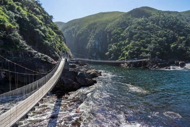
The eastern end — Storms River (and Nature’s Valley)
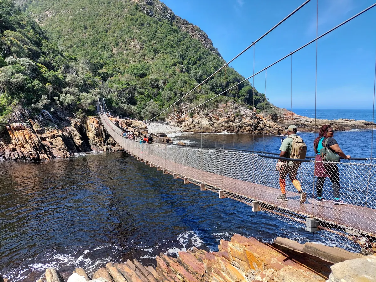
Heading east, the route officially ends at Storms River Mouth, inside the Tsitsikamma section of Garden Route National Park. The iconic suspension bridge across the river mouth is the photographic bookend of the region. Most travellers actually finish their trip in Nature’s Valley, 30 minutes before Storms River, because it’s the last proper village with self-catering and restaurants before you enter the park.
Why Witsand and Jeffreys Bay aren’t officially on the route
People often ask us about Witsand, Stilbaai and even Jeffreys Bay. They’re lovely — they’re just not on the Garden Route. Witsand and Stilbaai fall under the Overberg district to the west; Jeffreys Bay belongs to the Sunshine Coast in the Eastern Cape. Stick to the official corridor — there’s already more than a week of sightseeing between the two ends.
UNESCO MAB Biosphere Reserve (2017)
In 2017, UNESCO designated the corridor a Man and the Biosphere (MAB) Reserve, recognising the overlap of fynbos, Afromontane forest, estuaries and marine habitats. It’s the clearest proof that the Garden Route isn’t just a pretty drive — it’s a formally protected ecological corridor.
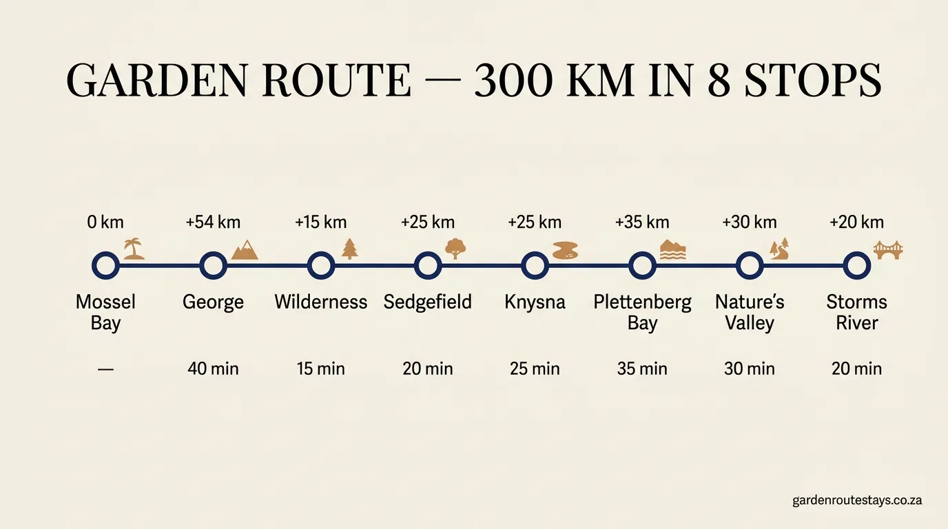
Garden Route map: distances and driving times
End-to-end on the N2, Mossel Bay to Storms River is about 230 km of actual tarmac, or roughly 3 hours of driving with no stops. The commonly cited “300 km” figure reflects the full touristic stretch — including the Tsitsikamma park road, Nature’s Valley detour off the N2, and the loop down to Storms River Mouth from the Tsitsikamma gate. Both numbers are right; they just measure different things. Here’s the town-by-town map of the route along the N2, west to east, with cumulative distances and drive times:
| Stop | Cumulative km | From previous | Drive time | Known for |
|---|---|---|---|---|
| 1. Mossel Bay | 0 km | start | — | Pinnacle Point caves, warm-sea beaches |
| 2. George | 50 km | +50 km | 40 min | Outeniqua Pass, airport (GRJ) |
| 3. Wilderness | 66 km | +16 km | 15 min | Lakes, forest, Map of Africa |
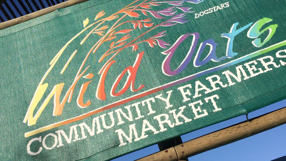
| 4. Sedgefield | 89 km | +23 km | 20 min | Slow Town, Wild Oats market |
| 5. Knysna | 114 km | +25 km | 25 min | The Heads, oysters, lagoon |
| 6. Plettenberg Bay | 146 km | +32 km | 35 min | Beaches, whales Jun–Nov |
| 7. Nature’s Valley | 176 km | +30 km | 30 min | Tsitsikamma gateway, forest beach |
| 8. Storms River | 230 km (end) | +54 km | 40 min | Suspension bridge, Bloukrans bungee (216 m) |
A quick note on that Bloukrans Bridge entry — it’s the world’s highest commercial bridge bungee at 216 m, sitting right between Nature’s Valley and Storms River. You don’t have to jump. You do have to pull over for the view.
Town-by-town along the Garden Route
Mossel Bay — the western gateway
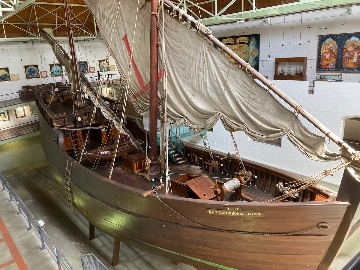
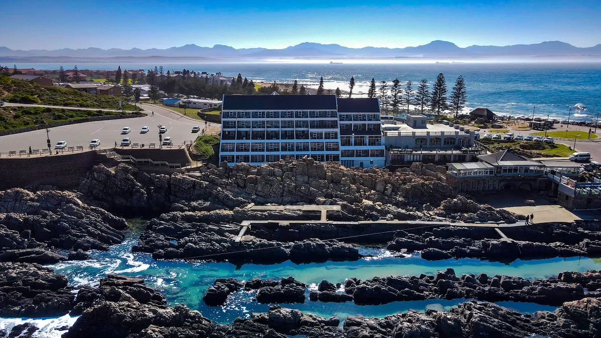
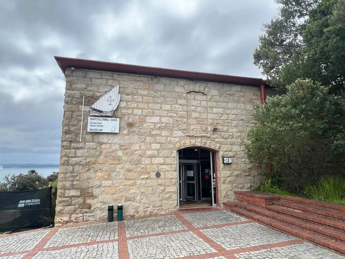
Where the road turns coastal. Mossel Bay is best known for its long swimming beaches, the Bartolomeu Dias Museum Complex (the 1488 Portuguese landing point) and some of the warmest sea temperatures on the route. The Point has a small but lively restaurant scene, and sunsets over Munro Bay are quietly the best on the western end. Good for a one- or two-night stop before you push east, and a sensible first night if you’re driving in late from Cape Town.
George — the inland hub
The biggest town in the region and home to George Airport (GRJ) — the only mid-route airport and the smartest fly-in option if you want to skip the Cape Town drive. George itself sits inland at the foot of the Outeniqua Mountains, which means cooler evenings, excellent golf (Fancourt, Oubaai) and easy access to the inland passes. It’s not a beach town but it makes a quietly efficient base. Stays in George often work out cheaper than coastal equivalents, and the coast is a 15-minute drive down the Outeniqua Pass.
Wilderness — lakes, forest, beach
A short hop east of George, Wilderness is the smallest and most peaceful of the main towns. The Wilderness section of Garden Route National Park protects a chain of lakes and estuaries behind the dunes — rent a canoe, tube the Touws River, or walk the boardwalk to the Map of Africa viewpoint. The main beach is 8 km long and almost always quiet. If you want forest walks and an early night, this is your town.
Sedgefield — South Africa’s first Slow Town
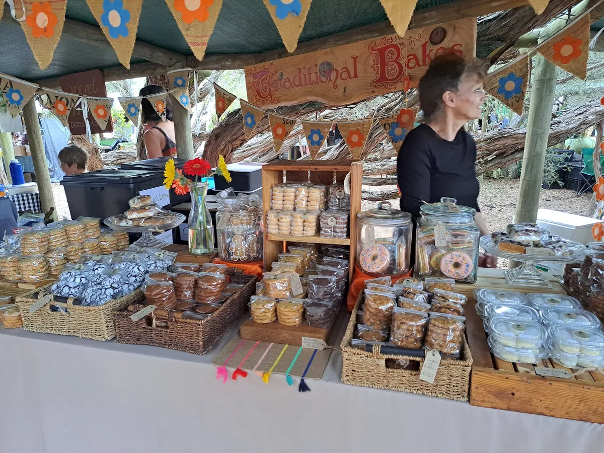
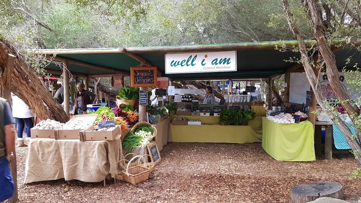
Sedgefield became the country’s first official Cittaslow (“Slow Town”) in 2010, and it wears the title well. Swartvlei estuary hems it in on one side, the sea on the other, and the Saturday-morning Wild Oats Community Farmers’ Market is the single best foodie stop on the route. Expect biltong, local oysters, fresh sourdough and the kind of coffee that makes you linger. Sedgefield stays suit travellers who want Knysna’s scenery without Knysna’s traffic.
Knysna — the estuary town and the Heads
Knysna is the postcard stop. The two sandstone cliffs of The Heads flank a narrow, dangerous channel into one of the largest estuaries in South Africa, and the lagoon behind them is where the town’s oyster industry, houseboat hire and sunset cruises all happen. The annual Oyster Festival in July pulls a proper crowd. Knysna is more developed than its neighbours, which cuts both ways — more choice of restaurants, but a busier main road. Knysna self-catering on the lagoon side is the sweet spot.
Plettenberg Bay — the beach capital
If the Garden Route has a beach capital, it’s Plett. Long white sand at Robberg, Central and Lookout Beaches, a proper surf break, dolphins year-round, and Southern Right and Humpback whale sightings from June to November. Plett is busier and pricier than the western towns — December and January are the peak weeks, when Joburg empties out onto Plett’s beaches — but out of season it’s extraordinary. Plett beach houses book up fastest for the year-end weeks, so plan early if that’s when you’re coming. For the full whale watching Plettenberg breakdown, see deeper whale-watching deep-dive.
Nature’s Valley & Storms River — the eastern end
Nature’s Valley is a tiny village tucked between the Groot River Lagoon, a long forest beach and the Tsitsikamma cliffs. There are no shops beyond a single general store and no cell signal on most networks — that’s the point. Twenty minutes further east, Storms River is where the Garden Route officially ends at the Storms River Mouth suspension bridge inside the Tsitsikamma section of Garden Route National Park. This is also the start of the 5-day Otter Trail, one of the country’s most sought-after hikes.

How many days do you need for the Garden Route?
The honest answer depends on whether you want to tick boxes or actually rest. Here’s how we’d split it:
- 3 days: Rush job. Pick a single base — Plett or Knysna works well — and treat everything else as a day trip. You’ll see the Heads, one beach, and probably Tsitsikamma. You’ll miss the forest walks, the inland passes and half the food.
- 5 days: The sweet spot. Split between two bases: two nights in Mossel Bay or Wilderness, then three in Plett or Knysna. That’s enough time for one long hike, two proper beach days and the Tsitsikamma run.
- 7–10 days: How we’d actually do it — see our day-by-day 7-day Garden Route itinerary for the worked example. Three or four bases, time for the Robberg Peninsula hike, a Wild Oats market breakfast, a day over the Outeniqua Pass or the Route 62 loop, and a weather-day to do nothing.
Most first-timers underestimate drive times. Google Maps shows pure N2 driving; it doesn’t account for the Knysna lagoon bridge in season, the lunch stop that becomes three hours, or the Bloukrans viewpoint pullover. Add 30–50% to every estimate and you’ll finish days on time.
Which end should you start from?
From Cape Town (west to east) is the most common approach. Cape Town to Mossel Bay is about 400 km / 4 hours on the N2 — doable in a morning with Swellendam as a coffee stop. You then work eastward, finishing at Storms River and either driving back or continuing to Gqeberha.
From Gqeberha (east to west) flips the script. Storms River is your first taste of the route after about 2 hours on the N2, and you end in Mossel Bay with the Cape Town road open ahead — ideal for a one-way rental flying out of Cape Town.
Fly into George. The middle-route option. Apartments in Wilderness or stays in Sedgefield put you 20 minutes from the airport and within 45 minutes of five of the six main towns. For a four- or five-day trip, this is the lowest-friction way to do it.
The Route 62 alternative. Many travellers make the Garden Route a loop by returning via Route 62 — the inland road through the Klein Karoo, past Oudtshoorn’s ostrich farms and the Cango Caves.
Climate, ecology and why it’s called the Garden Route
The “Garden” part of the name isn’t marketing. The region sits in a rare climate pocket where year-round rainfall meets mild Indian Ocean temperatures. Summers average 22–28°C, winters 10–18°C, and there’s no month where the landscape properly browns out. The result is the greenest stretch of coast in the country.
Ecologically, three big biomes collide here: fynbos (the endemic Cape floral kingdom), Afromontane forest (South Africa’s largest indigenous forest, around Knysna and Tsitsikamma) and coastal estuaries. Roughly 300 bird species have been recorded, from Knysna Turacos to African Oystercatchers. Offshore in Plett you can spot the “Marine Big 5” — whales, dolphins, sharks, seals, penguins — without leaving the bay.
The whole corridor is protected as the UNESCO Garden Route Biosphere Reserve (designated 2017), and three sections of Garden Route National Park — Wilderness, Knysna, and Tsitsikamma — anchor the conservation story. As a practical bonus for family travellers, the whole region is malaria-free year-round, which is not something you can say about most of South Africa’s big-draw wilderness destinations.
Planning your stay
The six main Garden Route towns each have their own personality — beach-focused Plett, forest-edged Wilderness, market-town Sedgefield, lagoon-town Knysna, family-friendly Mossel Bay, and George as the steady inland hub. The accommodation you pick shapes your trip as much as the drive does. We’d suggest splitting your nights across at least two towns so you wake up somewhere different halfway through.
Browse self-catering homes, apartments and guest houses across all six towns to build your itinerary around the places that fit you best — and if in doubt, a couple of nights in Wilderness or Sedgefield is the most forgiving middle-route base.
Sources
- Garden Route National Park — SANParks
- Garden Route District Municipality
- UNESCO Garden Route Biosphere Reserve
- South African Tourism — Garden Route
Frequently asked questions
Where is the start and end of the Garden Route?
The Garden Route officially runs from Mossel Bay in the Western Cape to Storms River Mouth in the Eastern Cape — a roughly 230 km stretch of coastline along South Africa's N2 highway, passing through George, Wilderness, Sedgefield, Knysna, Plettenberg Bay and Nature's Valley along the way.
What is the Garden Route in South Africa?
A formally defined region set by the Garden Route District Municipality and echoed by SA Tourism and SANParks. It's a roughly 230 km coastal corridor from Mossel Bay to Storms River, anchored by Garden Route National Park and designated a UNESCO Biosphere Reserve in 2017.
How long does it take to drive the Garden Route?
End-to-end on the N2 is about 230 km, or roughly 3 hours of driving with no stops. Realistic trip lengths are 3–5 days for a tick-box run, 5–7 days for the sweet spot, and 7–10 days if you want time for hikes, markets and weather days. Add 30–50% to Google Maps estimates.
What towns are part of the Garden Route?
Eight stops along the N2, in order: Mossel Bay, George, Wilderness, Sedgefield, Knysna, Plettenberg Bay, Nature's Valley, and Storms River. The six main self-catering towns are Mossel Bay, George, Wilderness, Sedgefield, Knysna and Plett.
What is the nicest town on the Garden Route?
It depends on what you're after. Knysna is the postcard stop with the Heads and the lagoon; Plettenberg Bay is the beach capital; Wilderness is the quietest; Sedgefield is the slow-food stop; Mossel Bay is the best value; George is the practical base. Most first-timers pick Knysna or Plett — see our [Plettenberg Bay vs Knysna guide](/blog/plettenberg-bay-vs-knysna/) for the head-to-head.


